Caudell Spatial Intelligence
Uncompromising 3D Reality Capture
Uncompromising 3D Reality Capture
Large-scale terrain modeling requires systematic capture, scale, and comprehensive analysis. This project demonstrates our expertise in environmental modeling, combining systematic drone capture with ground control to deliver decision-grade terrain models. When you need to understand every contour, slope, and feature across hundreds of acres, photogrammetry provides the detail that traditional methods often miss.
Terrain Analysis & Visualization
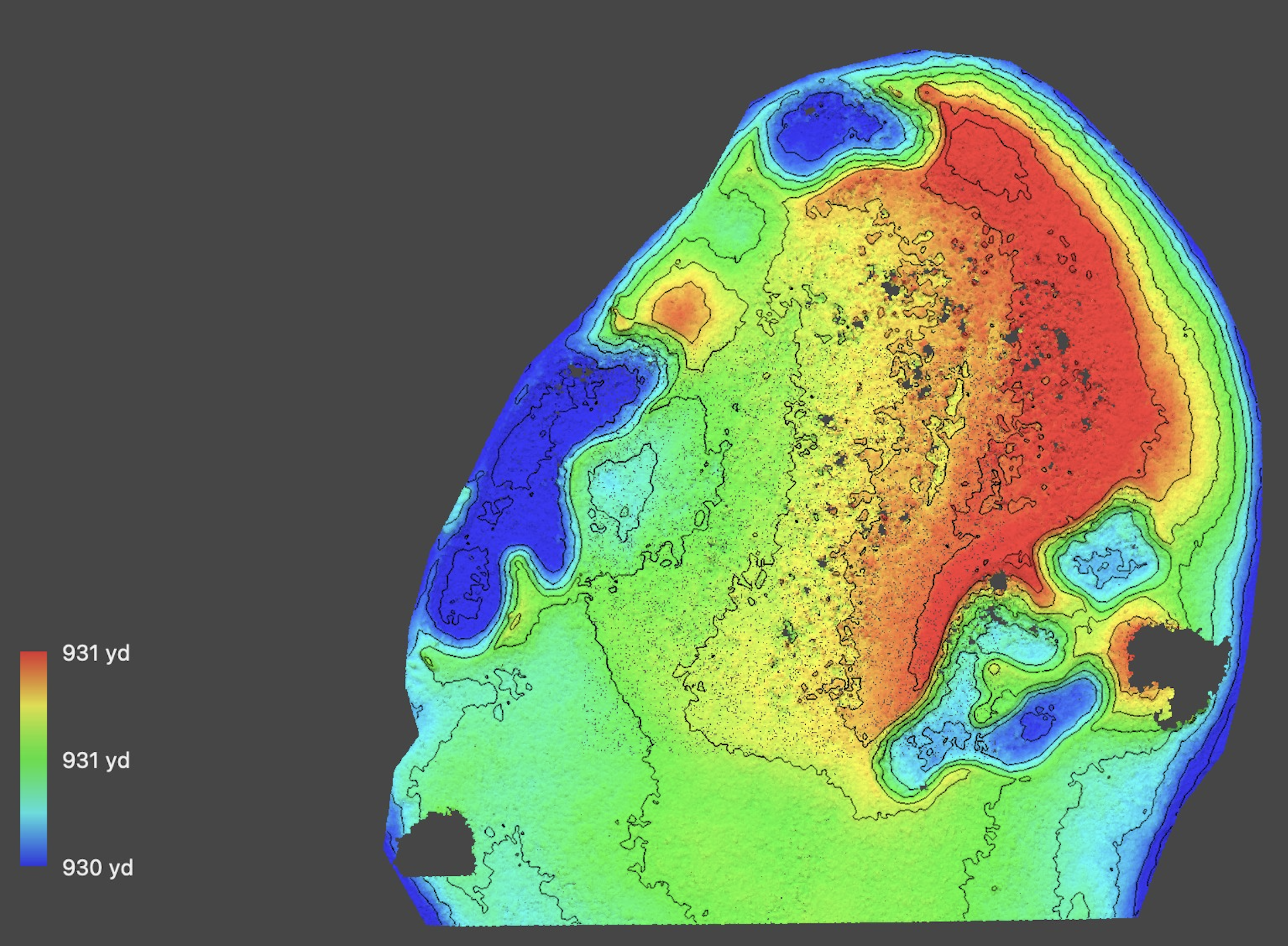
Project Scope: 200+ acres of terrain modeling for golf course redesign and construction planning
Capture Method: Systematic grid pattern at 250 ft AGL using DJI Matrice 4 Enterprise drone
Ground Control: 20 control points with Emlid Reach RS-3 GNSS receiver and RTK corrections
Deliverables: High-resolution point clouds, meshes, and decision-grade terrain models for design and construction
Equipment: DJI Matrice 4 Enterprise drone with integrated camera system
Processing: MacBook Pro M4 Pro with Metashape Pro for high-performance local processing
Output Formats: Point clouds (.las/.laz), meshes (.obj/.ply), orthomosaics, digital elevation models, and CAD-ready exports
Turnaround: On-site processing delivered to stakeholders within 24 hours
Integration: Direct collaboration with course architect for control point placement and deliverable optimization
Survey Partnership: Licensed surveyor collaboration available for survey-grade deliverables when required
Eliminate grading guesswork with precise slope and drainage models.
Digitize Your Site →